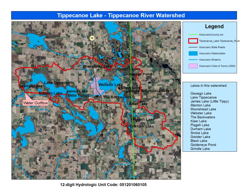
12-Digit Watershed Map
Lilly Center for Lakes & Streams
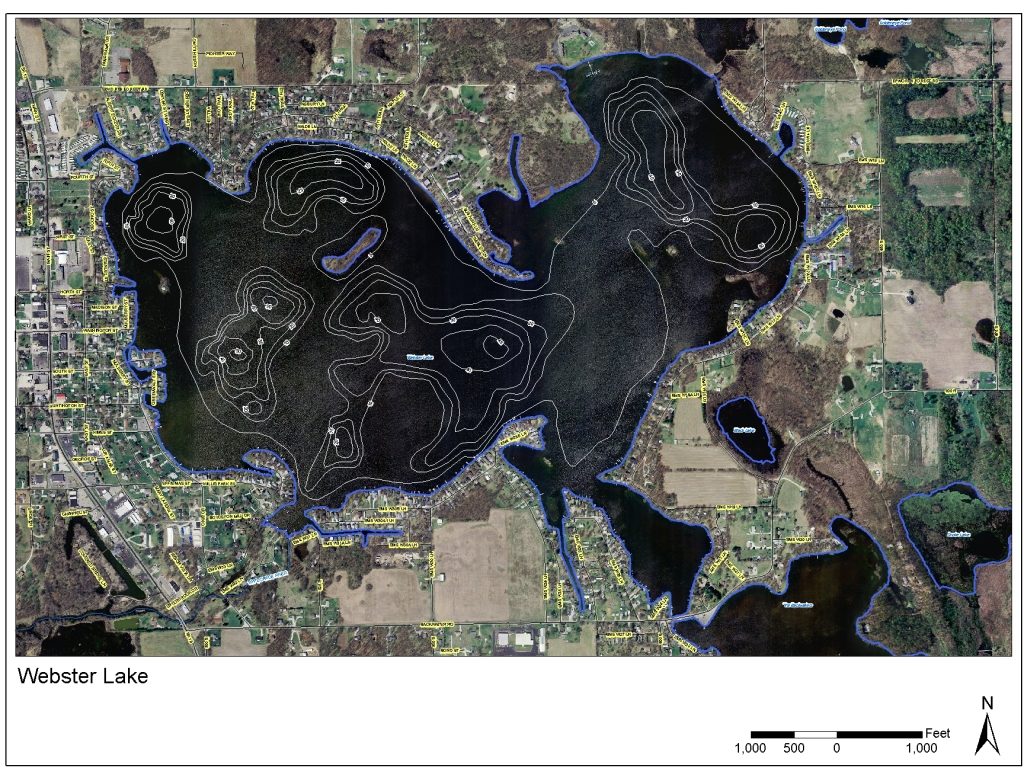
653 Acres
52 Feet
12.5 Feet
31459 Acres
From Backwaters (Tippecanoe River)
Tippecanoe River to the west
Public; 1 mile E. of N. Webster on Backwater Rd., access to Webster Lake via culvert from the Backwaters
Boat, Ski, Fish, Swimming at public beach in North Webster Town Park on Himes St.
Clay, Marl, Muck, Sand
Crappie, Muskellunge
Webster & Backwater – $131,362,100
Sensitive Population Advisory:
Bluegill
All Sizes: Unrestricted Consumption
Largemouth Bass
All Sizes: 1 meal per week
General Population Advisory:
Bluegill
All Sizes: Unrestricted Consumption
Largemouth Bass
Up to 17″: Unrestricted Consumption
Largemouth Bass
17″+: 1 meal per week
For the most up to date information, see the Indiana Department of Health’s website HERE.
Maps
12-Digit Watershed Map
Lilly Center for Lakes & Streams
See the boundaries of Webster Lake’s watershed.
Original Research from the Lilly Center
2025 Beneath the Surface
Lilly Center for Lakes & Streams
Beneath the Surface will equip you with information that will give your family, organization or agency the ability to care for Webster Lake.
2024 Beneath the Surface
Lilly Center for Lakes & Streams
Beneath the Surface will equip you with information that will give your family, organization or agency the ability to care for Webster Lake.
2023 Beneath the Surface
Lilly Center for Lakes & Streams
Beneath the Surface will equip you with information that will give your family, organization or agency the ability to care for Webster Lake.
2022 Beneath the Surface
Lilly Center for Lakes & Streams
Beneath the Surface will equip you with information that will give your family, organization or agency the ability to care for Webster Lake. We were impressed by the water clarity in Webster Lake in 2022!
2021 Beneath the Surface
Lilly Center for Lakes & Streams
Beneath the Surface will equip you with information that will give your family, organization or agency the ability to care for Webster Lake. In 2021, we were especially amazed by the variety of microorganisms found in our water samples from the lake!
2015 Beneath the Surface
Lilly Center for Lakes & Streams
This is the original Beneath the Surface report, published in 2015. Learn about your lake’s health and compare it to other lakes in the county.
Comparative Water Quality Study
Lilly Center for Lakes & Streams
In 2007, the Lilly Center published this baseline study which compares 30 lakes throughout Kosciusko County.
2013 Lake Economic Impact Study: Property Value Report
Lilly Center for Lakes & Streams
When combined with additional property taxes generated due to lake presence, the total economic impact of Kosciusko County lakes is more than $313,383,000 annually.
2014 Blue-Green Algae Study Final Report & Appendix
Lilly Center for Lakes & Streams
This paper synthesizes three years of blue-green algae research (2010-13) conducted by the Lilly Center. We have continued to study the algae and its toxin in-depth.

Need more lake research?
Additional studies and fact sheets are just one click away. Learn about boating, zebra mussels, blue-green algae and more!