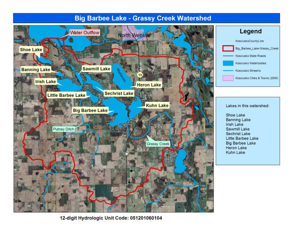
12-Digit Watershed Map
Lilly Center for Lakes & Streams
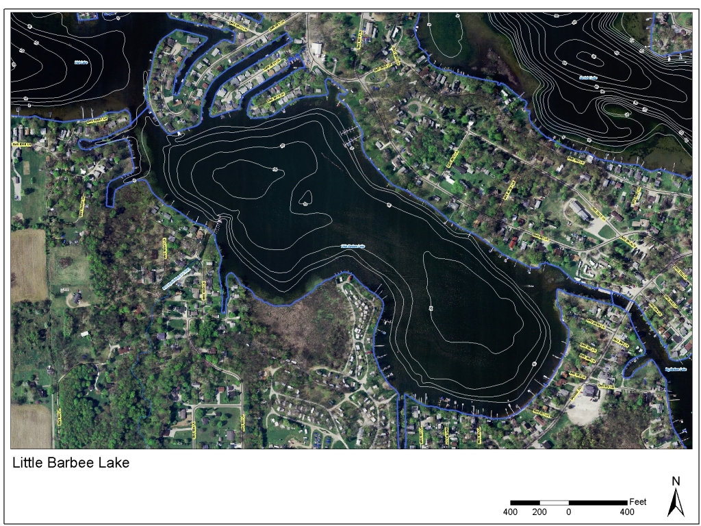
74 Acres
26 Feet
11 Feet
Putney Ditch from the south, Flow from Big Barbee Lake
To Irish Lake
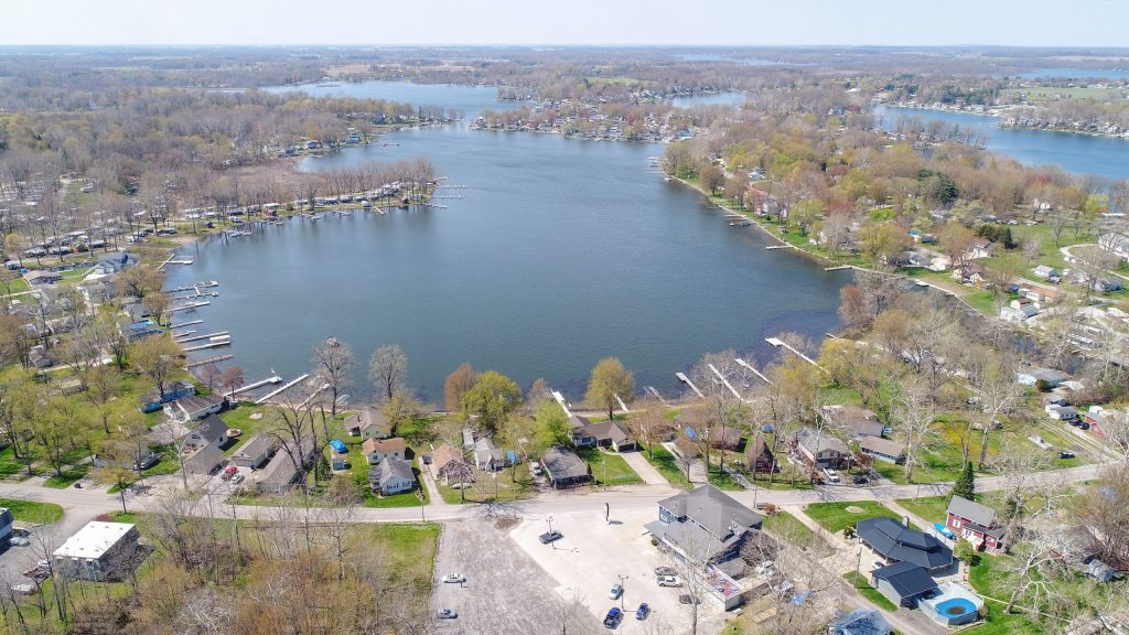
Public: For Barbee Chain: 2 mi S of N Webster on SR 13, then W on Rolling Ridge to Rattlesnake Dr.; Handicap accessible
Boat, Fish
Marl, Muck, Sand
Bluegill, Crappie, Largemouth Bass, Perch
Barbee Chain – $184,138,500
10 mph speed limit at all times
The Indiana Department of Natural Resources has no site specific advice for this lake.
For the most up to date information, see the Indiana Department of Health’s website HERE.
Maps
12-Digit Watershed Map
Lilly Center for Lakes & Streams
See the boundaries of the Barbee chain’s watershed.
Original Research from the Lilly Center
2023 Beneath the Surface
Lilly Center for Lakes & Streams
Beneath the Surface will equip you with information that will give your family, organization, or agency the ability to care for Little Barbee Lake.
2021 Barbee lakes chain water quality assessment, pre-and post-public sewer installation
Lilly Center for Lakes & Streams
This two-part study investigated lake water quality on the Barbee lakes chain before and after the installation of a public sewer system.
2014 Barbee Lakes Chain Pre-Public Sewer System Study
Lilly Center for Lakes & Streams
This project gives an overall assessment both the Barbee and Chapman lake chains. It establishes baseline conditions for the Barbee Chain before installation of a public sewer system.
2014 Blue-Green Algae Study Final Report & Appendix
Lilly Center for Lakes & Streams
This paper synthesizes three years of blue-green algae research (2010-13) conducted by the Lilly Center. We have continued to study the algae and its toxin in-depth.
2013 Lake Economic Impact Study: Property Value Report
Lilly Center for Lakes & Streams
When combined with additional property taxes generated due to lake presence, the total economic impact of Kosciusko County lakes is more than $313,383,000 annually.
Need more lake research?
Additional studies and fact sheets are just one click away. Learn about boating, zebra mussels, blue-green algae and more!